PLEXSYS Announces Release of StrataSim 1.5
Jun 7, 2022 | By: Tara Marta
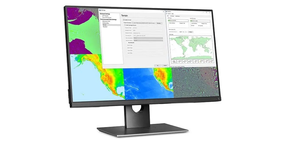
CAMAS, WA (June 7, 2022) – PLEXSYS Interface Products, Inc. (PLEXSYS) is pleased to announce the StrataSim 1.5 software release. StrataSim brings a centralized synthetic environmental data model that can respond to several environmental data dimensions, including terrain, weather, bathymetry, water awareness, and road routing. These capabilities are instrumental for several PLEXSYS products, including ASCOT and sonomarc, elevating entity, sensor, and radio models’ fidelity and interactions.
Key product features:
- A complete synthetic environmental data package, allowing customers to manage multiple aspects of environmental data in a centralized solution.
- The ability to load DTED and SRTM terrain data allows access to high-quality data in any setting.
- Comprehensive worldwide bathymetry data coverage leaves no gaps.
- The ability to model dynamic weather, where weather conditions change over time.
- For maximum flexibility, several query types are supported, including point, line, and area queries.
- Multiple deployment options support socket (HTTP or UDP) and direct (DLL) interfaces.
- Provides the ability to generate maps based on environmental data, allowing users to visualize underlying data easily.
- Extensive API documentation is available for easy integration.
Release focus:
This software release focused on several models and interfaces to expand StrataSim functionality. Changes included:
- Added support for Open Geospatial Consortium (OGC) Web Coverage Service (WCS), allowing terrain and bathymetry data to be obtained via WCS endpoints from compliant repositories.
- Added support for CAE weather server API, introducing a new channel for obtaining weather data.
- Improvements to dynamic weather initialization, simplifying the process of overriding weather data timestamps.
- Added support for Windows 11.
“StrataSim combines elements of synthetic environment modeling with robust data management features, all without sacrificing performance,” said Davor Braut, StrataSim Product Manager. “We are excited to offer another great solution to help customers build immersive training environments.”
For more information about this product, visit the StrataSim webpage. To learn more about other PLEXSYS solutions, contact our subject matter experts at info@plexsys.com.
About PLEXSYS
Founded in 1986, PLEXSYS is a modeling and simulation (M&S) software company with 35+ years of delivering Live, Virtual, and Constructive (LVC) training readiness solutions and innovation. PLEXSYS’s portfolio includes core products such as the Advanced Simulations Combat Operations Trainer (ASCOT) for easy-to-use environment generation, Sonomarc for high-fidelity communications, and VADAAR for real-time video, audio, and data capture used to enhance training and after-action review. Allied forces and training centers worldwide deploy these technologies, delivering realism, interoperability, and operational relevance demanded in all domain environments today. PLEXSYS is a 100% employee-owned small business, with more than 200 full-time employees plus part-time consultants in nine states and four foreign countries.