PLEXSYS Releases StrataSim 1.5.1
Oct 13, 2022 | By: Tara Marta
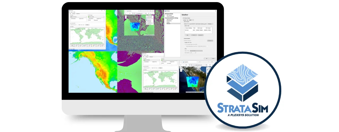
CAMAS, WA (October 13, 2022) – The PLEXSYS Utilities Team is pleased to announce the StrataSim 1.5.1 software release. StrataSim brings a centralized synthetic environmental data model that can serve several dimensions of environmental data, including terrain, weather, bathymetry, water awareness, and road routing. These capabilities are instrumental for several PLEXSYS products, including ASCOT and sonomarc, elevating the fidelity of entity, sensor, and radio models and their interactions.
Key Product Features
- Full synthetic environmental data package, allowing customers to manage multiple aspects of environmental data in a centralized solution.
- The ability to load DTED and SRTM terrain data allows access to high-quality data in any setting.
- Comprehensive worldwide bathymetry data coverage leaves no gaps.
- Ability to model dynamic weather, where weather conditions change over time.
- For maximum flexibility, several query types are supported, including point, line, and area queries.
- There are multiple deployment options, supporting socket (HTTP or UDP) and direct (DLL) interfaces.
- It provides the ability to generate maps based on environmental data, allowing users to visualize underlying data easily.
- Extensive API documentation is available for easy integration.
Release focus:
This software release focused on adding HTTPS support for StrataSim connections to external endpoints. Changes include:
- HTTPS support is based on SSL/TLS implementation certified by NIST accredited testing laboratory to be in compliance with the security level 1 requirement of FIPS 140-3.
- Open Geospatial Consortium (OGC) Web Coverage Service (WCS) endpoint connection to compliant repositories can rely either on HTTP or HTTPS.
- CAE weather server API connection can rely either on HTTPS or HTTPS.
- Integration with ASCOT 7 to display OGC Web Map Service (WMS) layers.
“StrataSim encryption support capabilities will be a nice upgrade for our customers, using SSL to secure requests and responses,” said Davor Braut, StrataSim product manager. “We are excited to continue expanding our solution to help customers build immersive training environments.”
For more information about this product, visit the StrataSim webpage. To learn more about other PLEXSYS solutions, contact our subject matter experts at info@plexsys.com.
About PLEXSYS
Founded in 1986, PLEXSYS is a modeling and simulation (M&S) software company with 35+ years of delivering Live, Virtual, and Constructive (LVC) training readiness solutions and innovation. PLEXSYS’s portfolio includes core products such as the Advanced Simulations Combat Operations Trainer (ASCOT) for easy-to-use environment generation, Sonomarc for high-fidelity communications, and VADAAR for real-time video, audio, and data capture used to enhance training and after-action review. Allied forces and training centers worldwide deploy these technologies, delivering realism, interoperability, and operational relevance demanded in all domain environments today. PLEXSYS is a 100% employee-owned small business, with more than 200 full-time employees plus part-time consultants in nine states and four foreign countries.